


Trainsity Kuala Lumpur LRT KTM
توضیحات Trainsity Kuala Lumpur LRT KTM
با نقشه های برداری با وضوح بالا برنامه ما، بدون زحمت در کوالالامپور و سایر شبکه های قطار عمومی جهانی پیمایش کنید. نقشه های مورد نیاز خود را انتخاب و دانلود کنید و از سطوح زوم دقیق بدون از دست دادن فضای ذخیره سازی لذت ببرید. برنامهها و فرکانسهای خطوط قطار و اولین/آخرین حرکت ایستگاهها (برای نقشههای دارای برنامه) را مشاهده کنید. بدون نیاز به اتصال به اینترنت به همه ویژگیها به صورت آفلاین دسترسی داشته باشید.
با برنامه بصری و کارآمد ما، راهی بینظیر برای کشف شبکههای قطار کشف کنید.
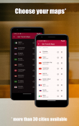
نقشهها در حال حاضر برای:
- سنگاپور
- کوالالامپور، مالزی
- ساپورو، ژاپن
- رسیف، برزیل
- برازیلیا، برزیل
- ونکوور، کانادا
- هنگ کنگ، چین
- بانکوک، تایلند
- مانیل، فیلیپین
- اوزاکا، ژاپن
- آمستردام، هلند
- هانوی، ویتنام
- اوترخت، هلند
- جاکارتا، اندونزی
- ریودوژانیرو، برزیل
- پالمبانگ، اندونزی
- ادمونتون، کانادا
- کلگری، کانادا
- سیدنی، استرالیا
- فوکوکا، ژاپن
- پاریس، فرانسه
- فورتالزا، برزیل
- مونترال، کانادا،
- رم، ایتالیا
- تورنتو، کانادا
- لیون، فرانسه
- الجزایر، الجزایر
- سائوپائولو، برزیل
- پرت، استرالیا
- شهر هوشی مین، ویتنام
- میلان، ایتالیا،
- نورنبرگ، آلمان،
- کپنهاگ، دانمارک،
- سوبرال، برزیل
- ناتال، برزیل
زبان های پشتیبانی شده توسط برنامه:
انگلیسی، مالایی، اندونزیایی، چینی، پرتغالی، ژاپنی، تامیلی، تایلندی، اسپانیایی، هلندی، ویتنامی، فرانسوی، ایتالیایی، عربی، آلمانی، دانمارکی
Trainsity Kuala Lumpur LRT KTM - نسخه 3.6.3
(21-05-2025)Trainsity Kuala Lumpur LRT KTM - اطلاعات APK
نسخه APK: 3.6.3حزمة: com.dom925.trainsity.kualalumpurآخرین نسخه Trainsity Kuala Lumpur LRT KTM
سایر نسخهها


اپلیکیشنها در دسته مشابه


